
Present-day mass wasting of the north polar ice cap on Mars
vorgelegt von
Shu Su, M. Eng.
ORCID: 0000-0002-7122-9393
an der Fakultät VI – Planen Bauen Umwelt
der Technischen Universität Berlin
zur Erlangung des akademischen Grades
Doktorin der Ingenieurwissenschaften
- Dr.-Ing. –
genehmigte Dissertation
Promotionsausschuss:
Vorsitzender: Prof. Dr. Frank Flechtner
Gutachter: Prof. Dr. Jürgen Oberst
Gutachter: Prof. Dr. Harald Hiesinger (Universität Münster)
Gutachterin: Dr. Ganna Portyankina (DLR Berlin)
Tag der wissenschaftlichen Aussprache: 27. Juni 2024
Berlin 2024
PHD THESIS
“Present-day mass wasting of the north polar ice cap on Mars”
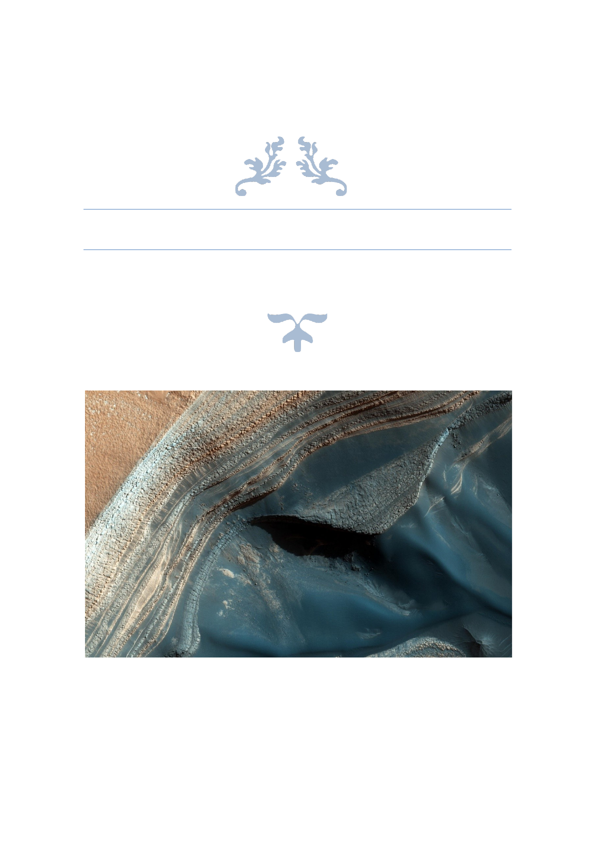
Credit: NASA/JPL-Caltech/Univ. of Arizona

Abstract
- 3 -
Abstract
Mars is a dynamic planet, exhibiting diverse active processes across its surface. Driven
by variations in the obliquity of the rotation axis and the eccentricity of the orbit, the
surface of Mars has experienced successive episodes of deposition and removal of
water ice. At the end of the last ice age, about 0.4 Myr ago, water ice has finally
deposited at the two poles, at the expense of loss from the mid-latitudes. Since then,
these polar ice deposits have been undergoing reworking with erosion and retreat in
response to climate change. In particular, at the north polar ice cap, prevalent surface
changes, such as avalanches and ice block falls, have been observed from high-
resolution satellite images. Ice block falls are likely the most active erosional process
that are consistently affecting the topography of the north polar ice cap. Although
avalanches are also prevailing, they are thought to carry mostly CO2 ice and dust.
Research on how ice block falls have been shaping the north polar ice cap, are limited
and incomplete. Therefore, in this work, I will address this interesting and significant
task. The main efforts of this thesis are as follows.
1). I have designed a pipeline to process the High Resolution Imaging Science
Experiment (HiRISE) raw images, generate HiRISE Digital Terrain Models (DTMs), and
carry out orthorectification, by using the Ames Stereo Pipeline software. The produced
DTMs generally conform to the criteria for orthorectifying raw images. This pipeline is
crucial for this work as the orthorectified HiRISE images are essential for monitoring
meter-scale changes at the north polar region through time.
2). I have proposed a solution to search for the sources of ice block falls at the
marginal steep scarps of the North Polar Layered Deposits (NPLD). The idea is to
identify the shadows of the detached ice-fragments, because the changes in shadow
patterns can attest to ice block fall events. An automated intensity-based change
detection method has been developed, and successfully applied to the study region to
look for ice block fall events. This automated approach has been evaluated to achieve
an average true positive rate of 97.6% and false discovery rate of 9.4% in identifying
the sources of ice block falls.
3). I have demonstrated that both the NPLD and the Basal Unit (BU) scarps are active
source areas of ice block falls, through observations and comparative analyses for the
first time. I have found that the amount of ice block falls increases with steeper slope
angles. That is why in general, the lower part of the NPLD scarps have much more ice
block falls as they are much steeper (can exceed 70°) than the upper part.
4). I have created a deep learning-driven change detection method to detect the
sources of ice block falls from the steep scarps of the NPLD, that is, to map the areas

Abstract
- 4 -
of the detached ice-fragments. The good performance and quick processing speed of
the developed model allow for studying large-scale areas efficiently.
5). I have marked all active scarps across the entire NPLD region based on the
available HiRISE images. Then, I have applied my developed deep learning approach
to detect all ice block falls. This is the first work to comprehensively quantify mass
wasting on the north polar ice cap.
6). I have estimated erosion and retreat rates for all currently active NPLD scarps
based on the volume of mass wasting, which suggests the potential ongoing
asymmetric retreat of the north polar ice cap. The erosion rates range from 0.001 to
0.88 m3 per Mars year per meter along the scarp, with retreat rates of up to ~6 mm per
Mars year (or ~3 mm/yr). Note that yr is one Earth year.
7). I have proven that BU undercutting is the driven factor for the occurrence of ice
block falls and setbacks of the NPLD steep scarps.
8). I have discovered that ice blocks vanished within the lifetime of HiRISE images and
discussed possible reasons regarding their disappearance.
This work builds an invaluable pool of knowledge about the erosion activity at the
martian north polar ice cap, which holds an important record of the planet’s climate
history. The results of this work provide important constraints to the present-day mass
flux and the topographic evolution of the ice cap in general. Discussions on the
disappearance of the fallen ice blocks open questions regarding the potential for
abundant mass wasting to generate liquid saline water. This intriguing possibility would
provide a new perspective on studying the evolution of Mars' climate and its potential
habitability.

Zusammenfassung
- 5 -
Zusammenfassung
Der Mars ist ein dynamischer Planet, auf dessen Oberfläche verschiedene aktive Geo-
Prozesse ablaufen. Angetrieben von Schwankungen in der Neigung der Marsachse
und der Exzentrizität der Umlaufbahn hat die Marsoberfläche aufeinanderfolgende
Zeitepisoden der Ablagerung und Abtragung von Wassereis durchlaufen. Am Ende der
letzten Eiszeit, vor etwa 0,4 Mio. Jahren, lagerte sich das Wassereis schließlich an den
beiden Polen ab, bei gleichzeitigem Rückgang in den mittleren Breitengraden. Seitdem
erleben diese polaren Eisablagerungen, bedingt durch Reaktionen auf den
Klimawandel, Erosion und Veränderungen. Insbesondere an der nordpolaren Eiskappe
wurden auf hochauflösenden Satellitenbildern häufige Oberflächenveränderungen wie
Lawinenabgänge und Eisfelsstürze beobachtet. Eisfelsstürze sind wahrscheinlich der
bedeutendste Erosionsprozess, der die Topografie der Nordpolarkappe nachhaltig
beeinflusst. Zwar kommen auch Lawinen vor, man geht aber davon aus, dass sie
hauptsächlich CO2-Eis und Staub transportieren. Die Forschung darüber, wie
Eisfelsstürze die Nordpolarkappe geformt haben, ist begrenzt und unvollständig. Daher
werde ich mich in dieser Arbeit mit dieser interessanten und wichtigen Fragestellung
befassen. In dieser Doktorarbeit wurde wie folgt vorgegangen.
1). Ich habe eine Pipeline entwickelt, um die Rohbilder des High Resolution Imaging
Science Experiment (HiRISE) zu verarbeiten, die HiRISE Digital Terrain Models (DTMs)
zu erzeugen und die Orthorektifizierung durchzuführen. Für diesen Prozess wurde in
dieser Arbeit die Software Ames Stereo Pipeline verwendet. Die erzeugten DTMs
entsprechen den Anforderungen für die Orthorektifizierung von Rohbildern. Diese
Pipeline ist für meine Arbeit von entscheidender Bedeutung, da die orthorektifizierten
HiRISE-Bilder die Grundlage für die zeitliche Nachverfolgung von metergenauen
Veränderungen in der Nordpolarregion bilden.
2). Ich entwickelte eine Lösung für die Suche nach den Ursachen von Eisfelsstürzen
an den steilen Felsklippen der Nordpolarablagerungen (North Polar Layered Deposits,
NPLD). Die Idee war es, die Schatten der abgelösten Eisfragmente zu identifizieren, da
diese Schatten Veränderungen durch Eisfelsstürze aufzeigen können. Es wurde eine
automatische Methode zur Erkennung der Veränderungen auf der Grundlage der
Bildintensität entwickelt und erfolgreich in der Untersuchungsregion angewandt, um
nach Eisfelsstürzen zu suchen. Dieser automatisierte Ansatz erreichte bei der
Identifizierung der Ursprungsregionen von Eisfelsstürzen eine durchschnittliche Rate
von 97,6 % echt positiver Ergebnisse und eine Rate falscher Entdeckungen von 9,4 %.
3). Ich habe durch Beobachtungen und vergleichende Analysen zum ersten Mal
nachgewiesen, dass sowohl die NPLD als auch die Basal Unit (BU) aktive Regionen
für Eisfelsstürze sind. Ich habe festgestellt, dass die Menge der Eisfelsstürze mit
steileren Neigungswinkeln zunimmt. Das heißt, im Allgemeinen geschehen im unteren
Loading more pages...